Involution is an intermediate-difficulty shared track that descends from the top of Barnicoat Range into Marsden Valley. The track passes through native bush the whole way down, and is the second-longest continuously descending MTB track within close range of any city in New Zealand (nearby Te Ara Koa is the longest).
| Details | |
| Distances | 3.7 km; circuit from car park with Barnicoat Walkway and Widdershins is 9 km; circuit with Glider Road and Widdershins is 11.5 km |
| Time Required | 1 hr 15 min going up (walking, from road end to top) |
| Trail Type | Shared track |
| Physical Difficulty | Moderate |
| Technical Difficulty | Intermediate |
| Uses | Walking, trail running and MTB |
| Direction | Either |
| Start Elevation | 715 m |
| Finish Elevation | 195 m |
If any layers fail to load, try clearing your cache and refreshing the page.
This elevation profile should be considered approximate. Its accuracy is determined by the quality of data available.

5 min from Stoke
All Marsden Valley and Barnicoat Range trails can be accessed off the end of Marsden Valley Road, 5 min from Stoke. At the end of Marsden Valley Road, just before the quarry, there is a car park on the right. Here you will find an information panel with a map and details on trail times and distances.
The uphill end of Involution starts on Jenkins Hill 4WD Road, right at the eastern end of Widdershins, at 715 m elevation. The most straight-forward way to get there is via either Barnicoat Walkway or Glider Road, and Widdershins. Both ends of Involution are signposted.
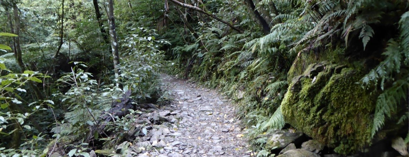
The track descends gently off the top of the range, dropping through a series of tight turns among beech and kamahi forest. Beyond the turnoff to Scout Track, Involution descends the face of the range through a couple of sweeping zig-zags with tight corners. The track heads around two lush gullies, crossing small tributaries of Poorman Stream in each, and then descends through another series of sweeping zig-zags through regenerating native bush. The bottom of Involution crosses the track to the historic Ngawhatu Weir, then drops into the gully next to Poorman Stream, winding for a further 150 m to the end at the Loop Track stream crossing. Turn right and follow the 4WD road 500 m back to Marsden Valley Road.
Involution is equally popular among walkers, runners and bikers, and can be completed in either direction. If you’re heading uphill, the native bush and winding track provide a more interesting experience and a gentler gradient than nearby Glider Road (just be cautious of mountain bikers coming down).
Involution has a technical rating of intermediate. There are lots of roots, particularly near the top of the range, which can be quite slippery when wet. There are narrow, rocky sections the whole way down, and some tight turns and tree trunks to negotiate. Involution is on Nelson City Council land (Marsden Valley Reserve) but is managed by the Nelson MTB Club.


Involution is an intermediate-difficulty shared track that descends from the top of Barnicoat Range into Marsden Valley. The track passes through native bush the whole way down, and is the second-longest continuously descending MTB track within close range of any city in New Zealand (nearby Te Ara Koa is the longest).
| Details | |
| Distances | 3.7 km; circuit from car park with Barnicoat Walkway and Widdershins is 9 km; circuit with Glider Road and Widdershins is 11.5 km |
| Time Required | 1 hr 15 min going up (walking, from road end to top) |
| Trail Type | Shared track |
| Physical Difficulty | Moderate |
| Technical Difficulty | Intermediate |
| Uses | Walking, trail running and MTB |
| Direction | Either |
| Start Elevation | 715 m |
| Finish Elevation | 195 m |
This elevation profile should be considered approximate. Its accuracy is determined by the quality of data available.
5 min from Stoke
All Marsden Valley and Barnicoat Range trails can be accessed off the end of Marsden Valley Road, 5 min from Stoke. At the end of Marsden Valley Road, just before the quarry, there is a small car park on the right. Here you will find an information panel with a map and details on trail times and distances. There is also plenty of room to park alongside the road.
The uphill end of Involution starts on Jenkins Hill 4WD Road, right at the eastern end of Widdershins, at 715 m elevation. The most straight-forward way to get there is via either Barnicoat Walkway or Glider Road, and Widdershins. Both ends of Involution are signposted.
The track descends gently off the top of the range, dropping through a series of tight turns among beech and kamahi forest. Beyond the turnoff to Scout Track, Involution descends the face of the range through a couple of sweeping zig-zags with tight corners. The track heads around two lush gullies, crossing small tributaries of Poorman Stream in each, and then descends through another series of sweeping zig-zags through regenerating native bush. The bottom of Involution crosses the track to the historic Ngawhatu Weir, then drops into the gully next to Poorman Stream, winding for a further 150 m to the end at the Loop Track stream crossing. Turn right and follow the 4WD road 500 m back to Marsden Valley Road.
Involution is equally popular among walkers, runners and bikers, and can be completed in either direction. If you’re heading uphill, the native bush and winding track provide a more interesting experience and a gentler gradient than nearby Glider Road (just be cautious of mountain bikers coming down).
Involution has a technical rating of intermediate. There are lots of roots, particularly near the top of the range, which can be quite slippery when wet. There are narrow, rocky sections the whole way down, and some tight turns and tree trunks to negotiate. Involution is on Nelson City Council land (Marsden Valley Reserve) but is managed by the Nelson MTB Club.
Updated 2 November 2020